Building Scalable Mobile Apps & Intelligent Spatial Systems
Hi, I'm Christopher Adedeji Somoye — a Mobile & Geospatial Developer with
4+ years of production experience. I specialize in high-performance Flutter
applications, offline-first architectures, computer vision edge diagnostics, and PostGIS spatial
pipelines.
Bridging high-performance client engineering with rigorous spatial analytics and machine
learning to deliver resilient products.
📱
Mobile Engineering
Developing production-grade iOS & Android applications using Flutter and Dart. Strong
advocate for Clean Architecture, robust state management, and offline-first data
synchronization.
Edge AI & Vision: TensorFlow Lite, PyTorch, On-Device Diagnostics
GIS Suites: Google Earth Engine, ArcGIS Pro, QGIS, Coordinate Datum Conversion
Google Earth EnginePostGISTensorFlow LiteSAR Remote Sensing
Portfolio Matrix
Featured Production Projects
Explore deployed mobile applications, geospatial intelligence systems, and machine learning
utilities. Click any project preview to inspect full screenshots.
Sentinel-1 SAR • GeoAI📸 Live App Preview
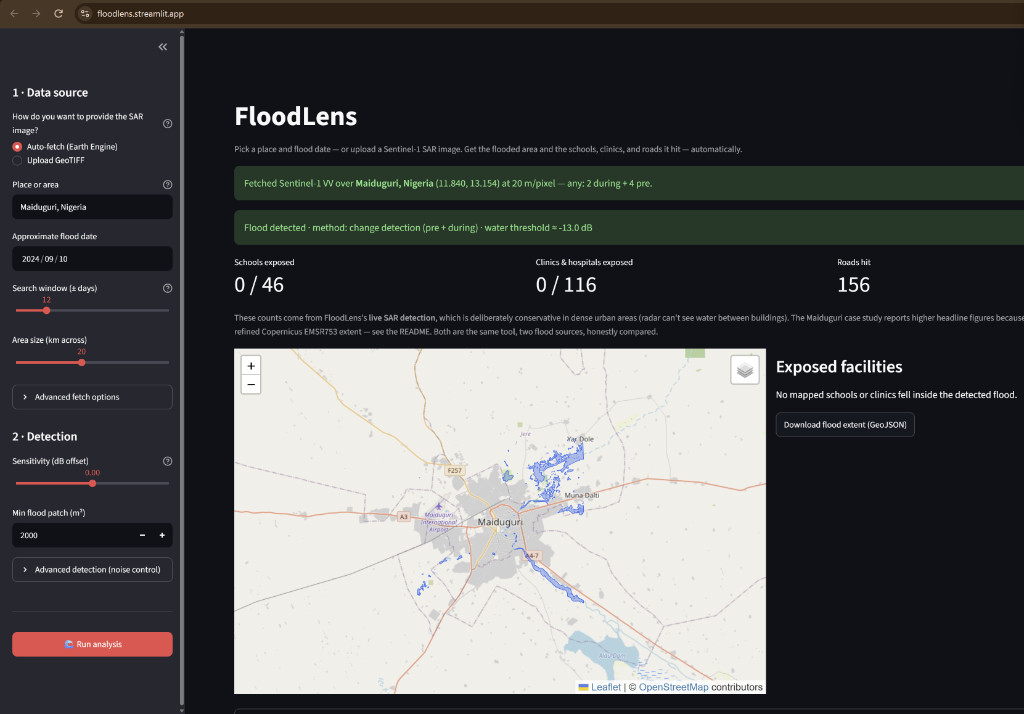
FloodLens: SAR Flood & Impact Intelligence
Emergency disaster intelligence platform combining Sentinel-1 SAR radar change detection with OpenStreetMap to automatically map flood extents and quantify exposed infrastructure (schools, clinics, and submerged transit roads) in real-time. Built for Map<>kathon 2026.
A comprehensive real-time ride-sharing application connecting commuters and drivers.
Features Mapbox turn-by-turn navigation, route optimization, in-app digital wallet, and
live GPS vehicle tracking.
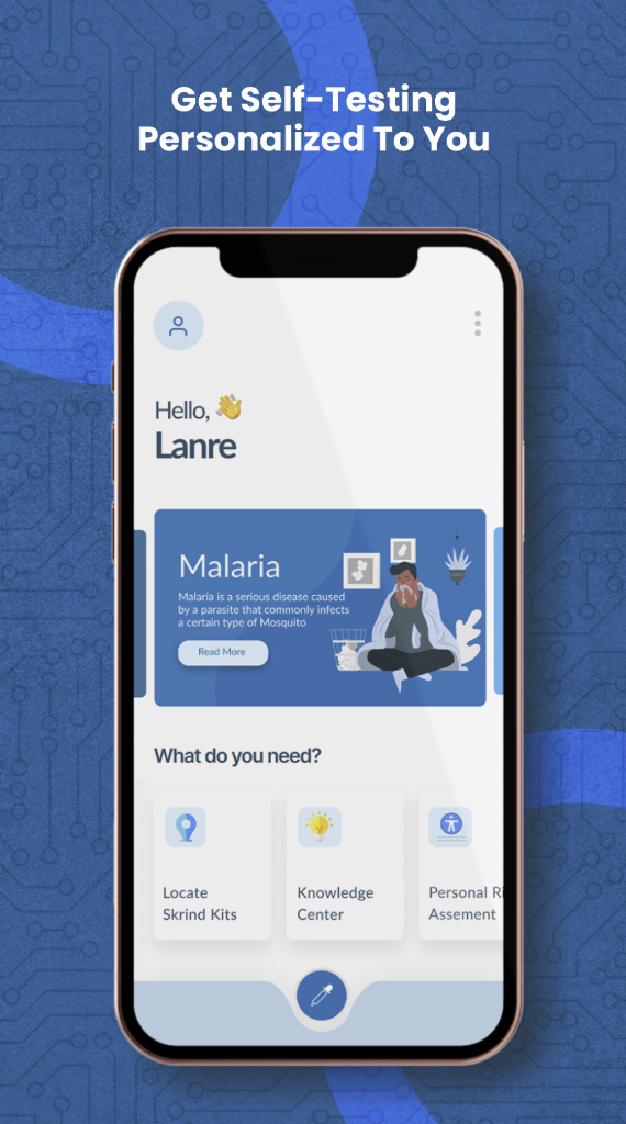
Medical diagnostic mobile system running on-device computer vision models achieving
90% diagnostic accuracy. Engineered with offline resilience for remote
clinical environments without reliable connectivity.
Replaced paper-based census collection with a spatially-aware mobile system, improving
location accuracy by 40% in unmapped regions via offline-first data
synchronization and PostGIS validation.
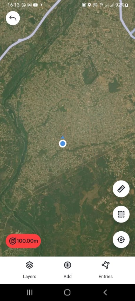
A robust field collection tool enforcing strict 5-meter GPS accuracy validation.
Equipped with vector tile caching and complete offline persistence for surveyors in
zero-network remote zones.
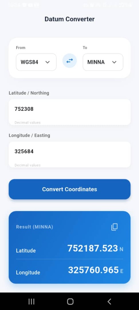
An internal mobile spatial tool built for the survey department to automate mathematical
coordinate transformations between Local and Minna Datums (UTM), eradicating manual
field calculation errors.
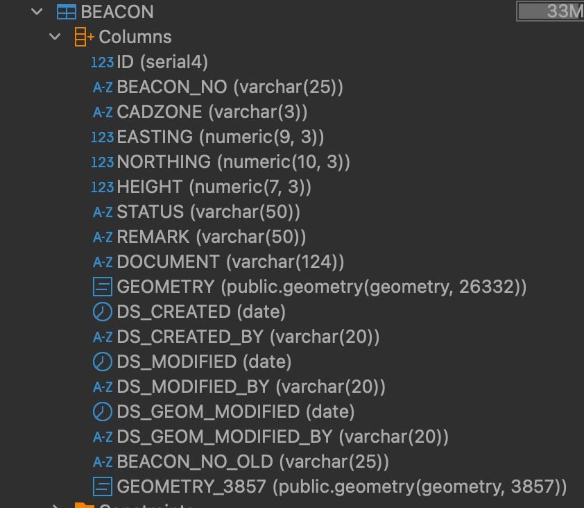
Enterprise Spatial Data Infrastructure at ENGIS. Spearheaded the migration of historical
paper cadastral survey plans using QGIS directly integrated with an authoritative PostGIS spatial database, with rigorous boundary QA in ArcGIS Pro against high-res satellite imagery.
PostGISQGISArcGIS ProPostgreSQLCadastral QA
Python • Analytics📸 1 Screen
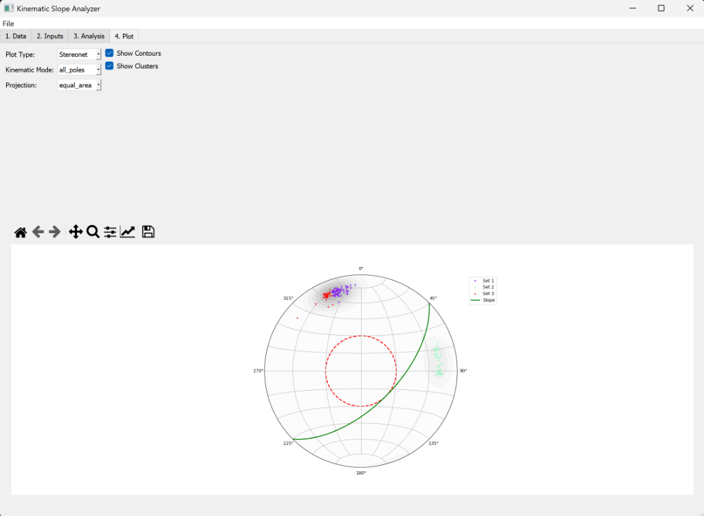
Desktop Geological Analysis
Industry-grade replica of DIPS geotechnical software for structural geologists.
Performs stereographic projections, kinematic slope stability analysis, and planar/wedge
failure assessments.
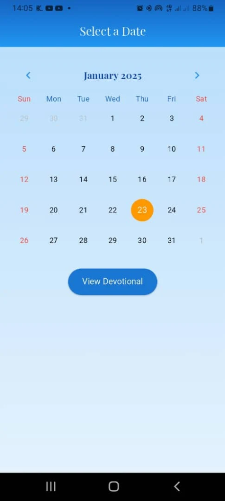
Accessible spiritual platform featuring 4 Bible translations, text-to-speech audio
reading, local journaling, and daily bookmarking built with SQLite and Provider state
management.
Track record of delivering production software, optimizing user-critical architectures, and
leading spatial workflows.
Mobile Developer (Flutter)
Acceede • Lagos, Nigeria (Remote)
March 2024 – Present
Architected and launched a cross-platform school management system (Teacher &
Parent apps) on Google Play & App Store using Flutter/MVVM, streamlining
operations by 30%.
Optimized application performance with GetX and Dio, slashing app crash rates by 75%
and cutting cold launch load times by 40%.
Spearheaded the digitization and migration of state-wide land survey records using QGIS directly connected to a central PostGIS database.
Built the 'Datum Converter' Flutter tool to automate local-to-Minna coordinate conversions, eliminating manual transcription errors across survey crews.
Executed spatial QA, boundary verification, and topology checks using ArcGIS Pro and high-resolution multispectral satellite imagery.
Mobile Dev & ML Engineer
Skrind • Remote
Feb 2024 – Jan 2025
Built a specialized medical diagnostics application with Flutter & Bloc,
embedding an edge computer vision pipeline achieving 90% diagnostic accuracy.
Designed scalable FastAPI & Docker backends for confidential, HIPAA-compliant
medical data exchanges.
Engineered an offline-first data synchronization engine to guarantee diagnostic
reliability in rural, low-connectivity clinics.
Mobile & Geospatial Developer
Milsat Technologies LTD • Abuja, Nigeria
July 2023 – Aug 2024
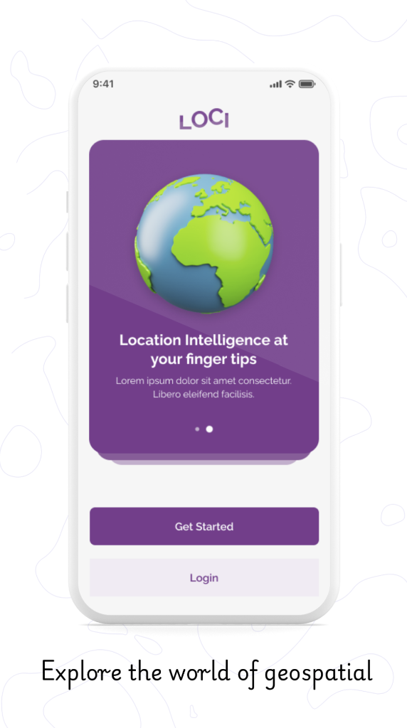
Led development of flagship geospatial mobile apps (LOCI & VCN), contributing to
a 50% revenue growth for commercial mapping offerings.
Improved field census data collection accuracy by 40% using geometry snapping and
offline polygon validation rules.
Engineered location-based tracking for Veterinary Council of Nigeria practitioners.
Machine Learning Tutor
Developer Student Clubs • Akure, Nigeria
March 2020 – Dec 2021
Mentored students in Python, Data Science, and Machine Learning algorithms with an
85% course satisfaction rating.
Ranked in the top 15% across multiple Zindi Africa Machine Learning competitive
benchmarks (terrain analysis, classification).
B.Tech in Remote Sensing & Geospatial Information
Systems
Federal University of Technology Akure (FUTA)
GPA: 4.25 / 5.00
Honors & Awards: 1st Place Winner — DITCH PLASTIC HACKATHON
(Geospatial AI for marine & urban plastic pollution tracking).
Core Rigor: Digital Image Processing, Satellite Remote Sensing, SAR
Interferometry, Geostatistics, Python Numerical Computing.
Capabilities
Technical Skills Matrix
Curated toolset and technologies honed across production engineering and spatial research.

 📸 Live App Preview